Lincoln/Cypress Transit-Oriented Communities
A strategic implementation plan for the Lincoln/Cypress Metro station area in Los Angeles. By Prince Adufah, Greer Cowan, Kevin Liu, Elliott Soong Shaw, Thomas Soudon-Verhague and Yasmina Yusuf, for Abode Communities.
The question
The City of Los Angeles owns a 94-space park-and-ride lot next to the Lincoln/Cypress station on the Metro A Line. The neighborhoods around it, Lincoln Heights, Cypress Park and Elysian Valley, are mostly Latino and Asian American and mostly working class, and rents in three of the four study areas rose faster than in the city or county between 2010 and 2020. Our client, the nonprofit developer Abode Communities, asked what it would take to build affordable homes on the lot.
What we did
We built the plan in five stages over the Fall 2022 quarter in UP 249 at the UCLA Luskin School of Public Affairs: a study area profile, a vision with goals and metrics, a stakeholder map, a land use analysis, and a set of infrastructure upgrades. The full report brings all five together.
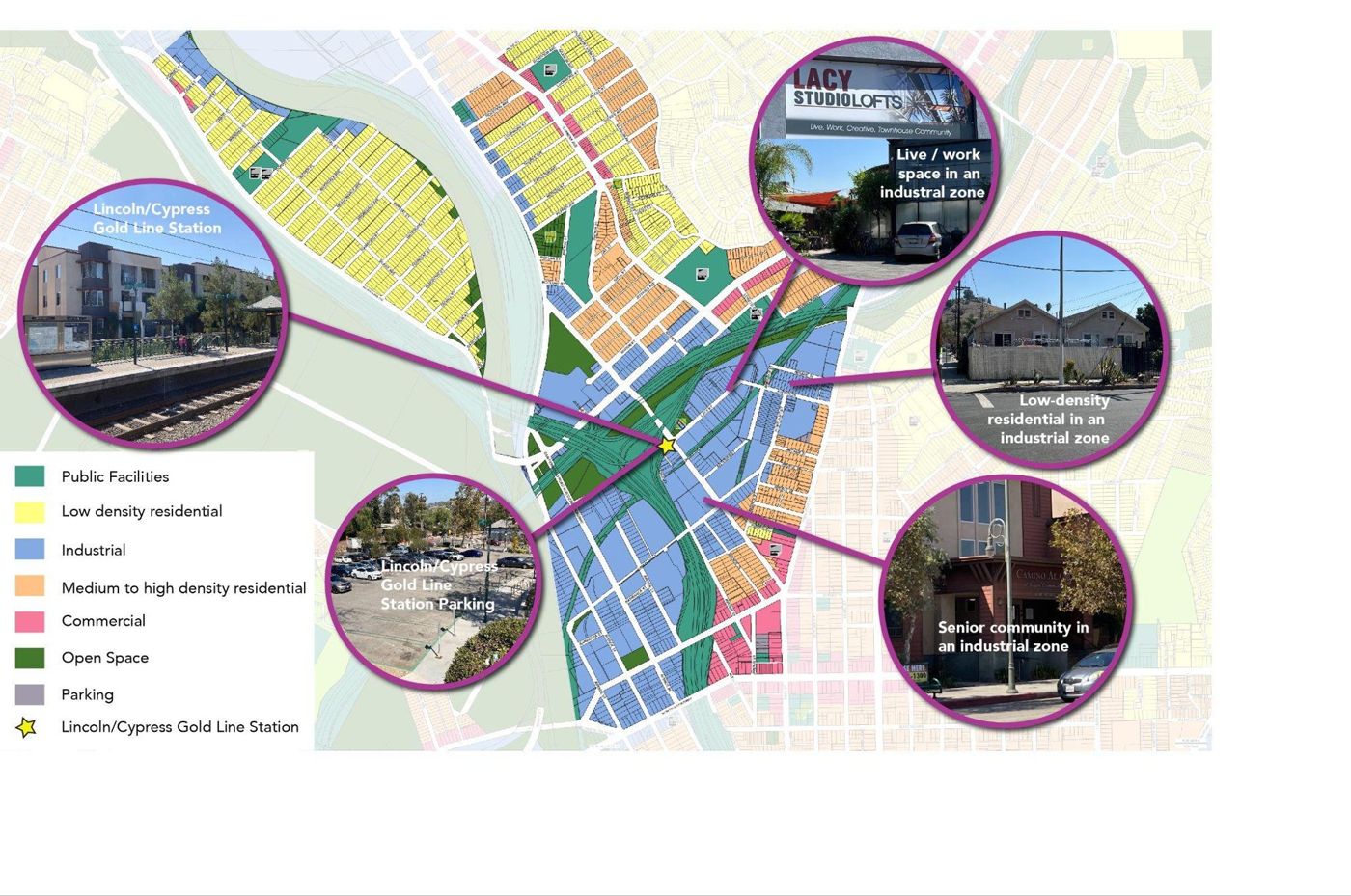
I built the study area and all the GIS maps in QGIS, including the walking and cycling catchment areas. I benchmarked residential, employment and commercial density against transit-supportive thresholds, mapped parking, bicycle and pedestrian infrastructure, and wrote the land use, policy and parking recommendations. I also edited the final report.
What we recommend
Build affordable, mixed-use housing on the lot and raise density around the station. Price parking on the city-owned lots and give residents free or subsidized transit passes. Make Avenue 26 and Figueroa Street safer to walk and cycle, with a road diet, crosswalks with flashing lights, bike lanes and better bus stops. Add stormwater capture, on-site composting and electric car sharing.
Read the full plan (PDF, 130 pages)