Whose Revitalisation?
Racial and social divides of revitalization programs in Detroit, 2014–2020. By Prince Adufah, Yuwei Wang and Louis Wiart.
The question
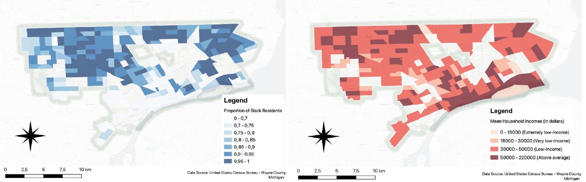
Detroit went bankrupt in 2013 and has since run a revitalization strategy funded partly by federal emergency money. There were concerns that the programs were spread unevenly across racial and social lines, feeding gentrification in the city center and displacing low-income Black residents. Our maps test that concern.
What we did
We mapped census tract data on race and mean household income for 2014 and 2020 in QGIS, and overlaid the city's Neighborhood Revitalization Strategy Areas for 2015 and 2020.
What we found
The program partly met its goal of bringing jobs and investment back to the city center. It did less for low-income Black residents and may have pushed some of them out of revitalized neighborhoods. We point to three likely causes: Black communities had little say in designing and running the program, much of it was handed to private actors, and mortgage lending was discriminatory.
Read the full study (PDF, 6 pages)